


Patù Itineraries
Four routes to discover Patù on foot or by bike, taking in history, archaeology, landscape and coast. All itineraries start from Piazza Indipendenza, in the heart of the village.
Historical-urban route
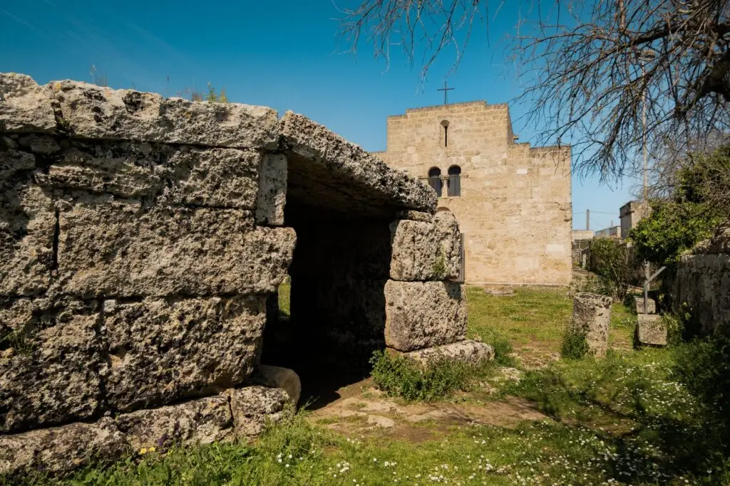
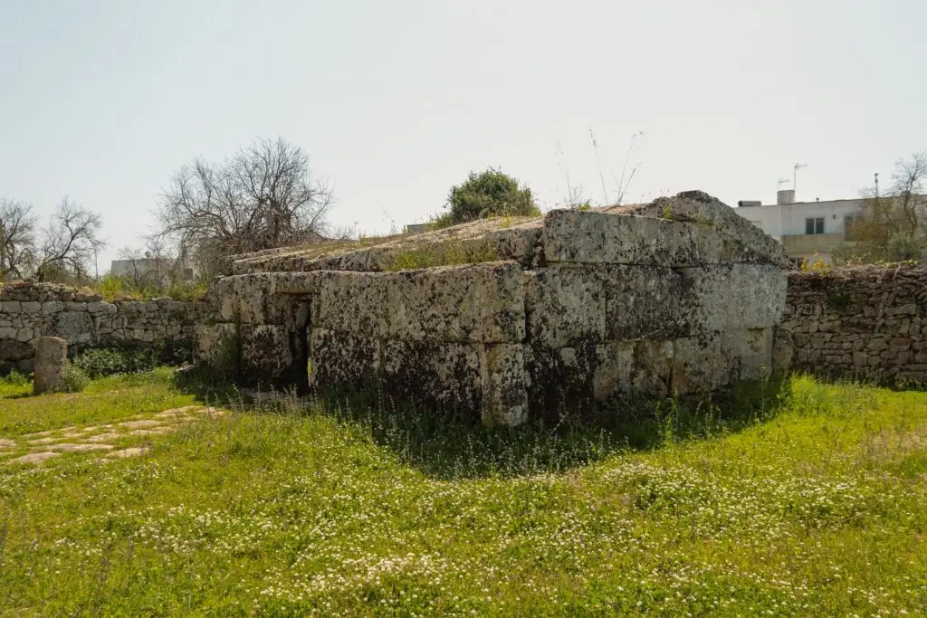
An easy itinerary, designed to bring together history, popular culture and the rural landscape.
The route starts from the central Piazza Indipendenza, where you can admire the Church of San Michele Arcangelo (16th century), the majestic Palazzo Liborio Romano and the underground grain silos visible directly from the road surface. Then along via Giuseppe Romano, the heart of the village’s daily life (newsagent, barber, tobacconist, post office), where the Church also stands. After a (coffee) break, you continue towards the countryside of Vereto along via Martiri d’Ungheria.
Along the lane known as “Campo li puzzi”, you come across the “pozzo sulvano” (an old public well), threshing floors, henhouses and dry-stone walls with steps leading into the fields. On this stretch you can see the first anthropological traces: apotropaic stone sculptures known locally as “Cucuruzzi”, placed on the walls as a symbolic warning to would-be vegetable thieves. The route continues to the old masseria “Sant’Aloia”, now restored, which stands in a strategic position at the foot of the hill of Vereto.
Heading towards the historic centre, you reach the area of piazza Marco Pedone, where the most important sites are concentrated:
- Centopietre Monument, a 9th-century mausoleum built with reused blocks from Vereto;
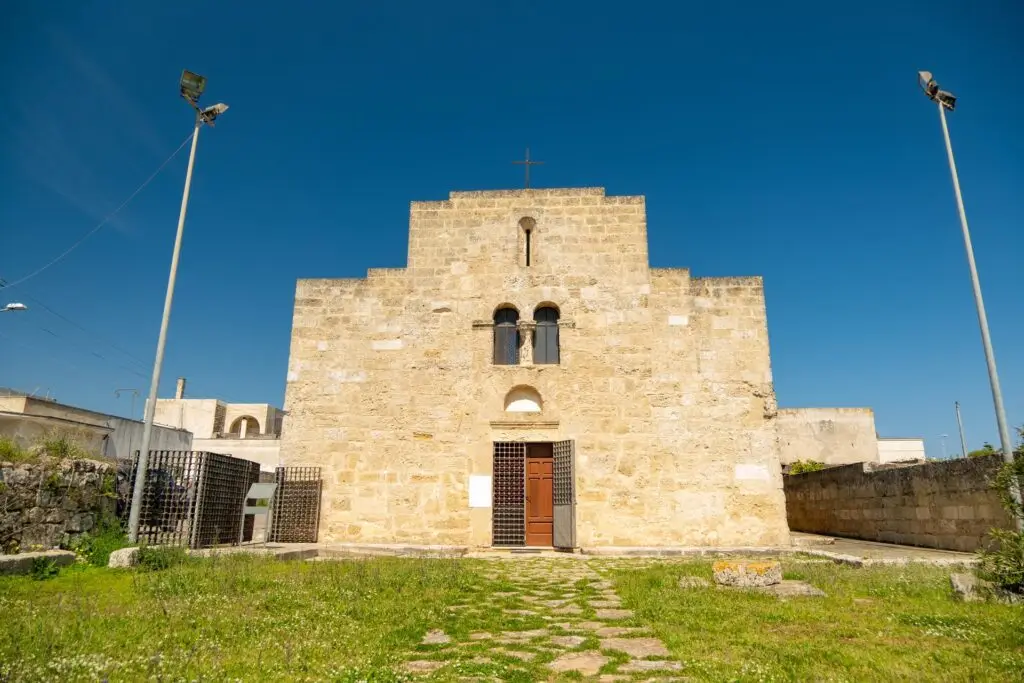
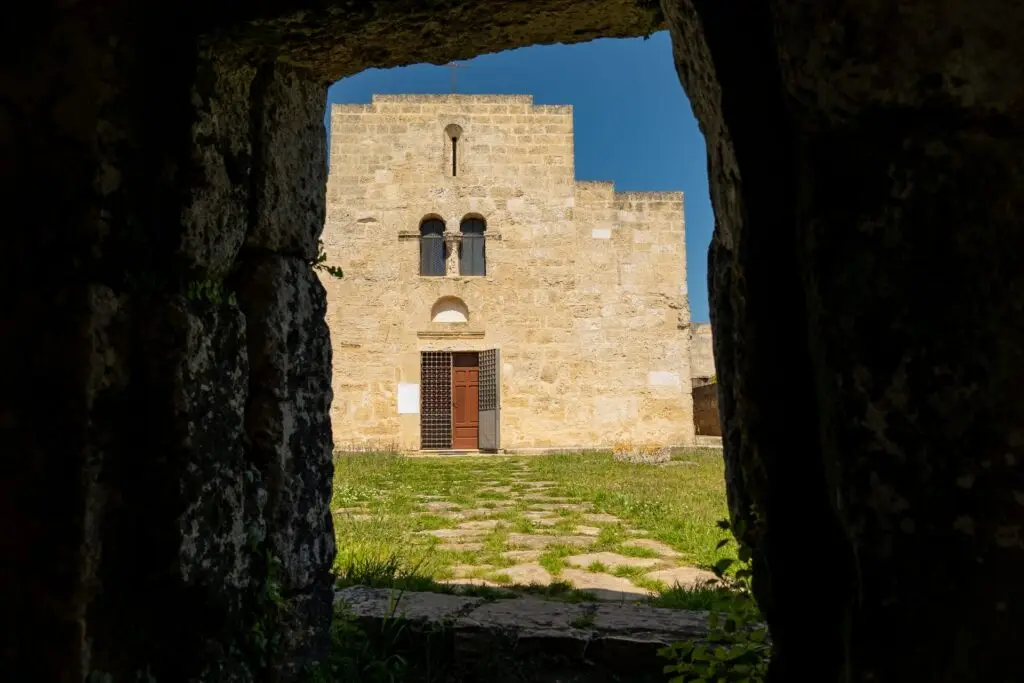
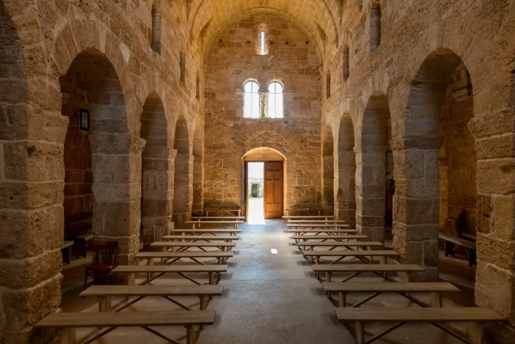
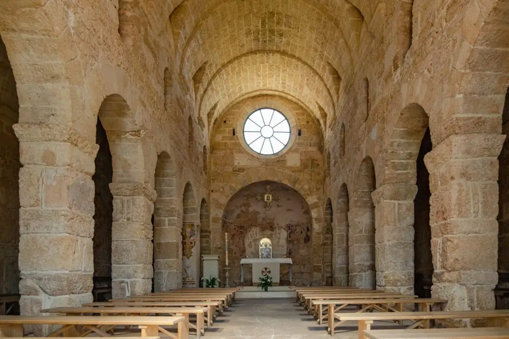
- Church of San Giovanni Battista, an ancient place of worship probably dating back to the 6th century;
- Shrine of Sant’Aloia, a mysterious structure linked to the cult of Sant’Eligio and to the old livestock fair organised by the “nzinghiri”;
- Underground Olive Press, an old “trappeto” carved into the rock, recently brought back to light beneath the square.
The return route towards Piazza Indipendenza passes along via Principe di Napoli and via Enrico Toti, where you can see the remains of the Tower of the Fortino, or Castle, known as “Terra”. The itinerary ends by returning to via Giuseppe Romano and finally to the starting point.
Archaeological route
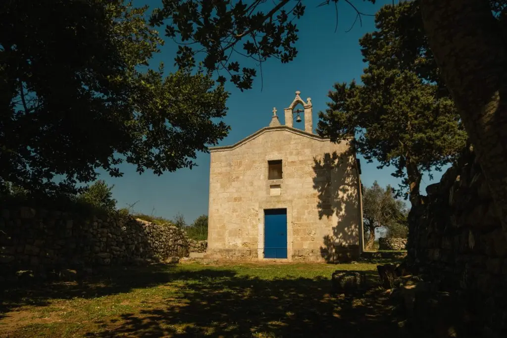
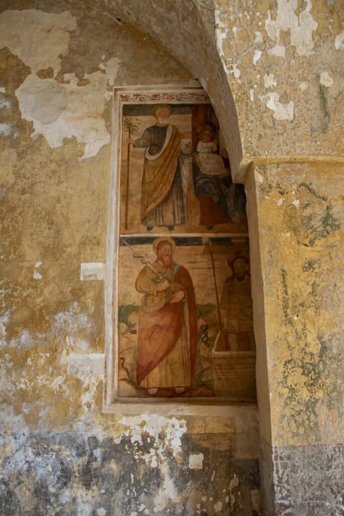
The archaeological route of the Vereto Ecomuseum focuses on the traces of the ancient Messapian and Roman civilisation on the hill of Vereto.
The route starts from the central Piazza Indipendenza, following the signs for the historical-urban route as far as the old masseria “Sant’Aloia”, where you turn right to climb the hill. Along the way you come across typical rural architecture such as caves carved into the rock, circular threshing floors and stone henhouses. Among these stands out the Grotta Suda, a partly collapsed karst cave linked to many popular legends.
At the top of the hill (approx. 155 m above sea level) are the votive shrines of Santa Rita and of the Sacred Heart of Jesus. From here you can enjoy a wide panorama stretching from the nearby towns to the sea of Santa Maria di Leuca. Heading west for about 400 metres, you reach the small 17th-century church, known for its important fresco of San Paolo and for the remains of an imposing early medieval apse.
Following the signs for the local road “Uschia Pagliare”, you walk along an equipped trail that runs beside the best-preserved remains of the walls of Vereto (4th–3rd century BC), where rows of large blocks of local stone are visible. The route crosses the provincial road 326 Patù-Morciano, passes the Masseria “Campanelle” and returns towards the votive shrines along the local road Serre II, before heading back down to the town of Patù.
Landscape route
An itinerary that focuses on the natural and rural wealth of the Patù area, especially around the Canalone di Volito.
The route starts from the central Piazza Indipendenza, following the signs for the historical-urban route as far as the old masseria “Sant’Aloia”, where you climb the hill to the two votive shrines at the top. From the shrines you turn left, cross the provincial road 192 (Patù-San Gregorio) and enter via “Munti Giuvanni”.
After about 1.5 km you reach a fork marked by the “Pajara de lu Scurdinu”, where you keep right to head into the natural heart of the itinerary. Here the Mediterranean scrub is dense and home to several species of wild orchids, edible wild herbs and the Rosa di San Giovanni. Along the sides of the ravine you can see shelters carved into the rock, evidence of ancient cave settlements.
The Pozzo di Volìto (“Puzzu de Vulito”) lies in the shade of laurel and walnut trees, and is a place the community is deeply attached to. Historically, its water was renowned for its healing properties, especially beneficial for those suffering from high blood pressure.
Climbing up from the well by a small stone staircase, you follow via Volito I for about 2 km through a unique rural landscape until you meet the SP 192 again. From here you enter the archaeological area of Vereto, where the landscape route connects with the archaeological one. On the way back you can choose to extend the walk towards the equipped trail of “Uschia Pagliare” to see the Messapian walls, or return towards the votive shrines via the Masseria Campanelle. The route ends by heading back down to the Masseria Sant’Aloia and returning to Piazza Indipendenza along via Principe di Napoli.
Coastal historical-landscape route
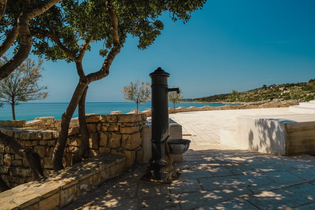
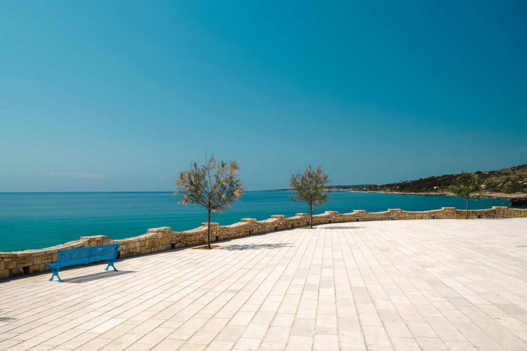
The coastal historical-landscape route of the Vereto Ecomuseum features elevation differences of about 150 metres between the coast and the hinterland.
The route starts from the central Piazza Indipendenza, following the signs for the historical-urban route as far as the old masseria “Sant’Aloia”, where you climb towards the votive shrines on the hill. From here you descend towards the Pozzo di Volìto, a place historically known for the healing properties of its water. Continuing along via Volito II towards the marina of Felloniche, you come across the “Pajara de Papa Fedele”, a rare example of a two-storey dry-stone building, once the summer residence of a parish priest. Beyond this point, the route offers a panoramic view of the sea.
Once you reach the beach of Felloniche, you walk along the Lungomare Magna Grecia and then climb towards the bay of San Gregorio. Here you can see the remains of an ancient structure made of stone blocks that served as a pier for Messapian and Roman ships. On top of the San Gregorio promontory stands the “Casino Pedone”, built where a 16th-century watchtower once stood. Sources also record that until the 1960s the bay was home to a tuna fishery.
Climbing back up from the coast, at the locality “Tisa o Vidino”, you can make a detour of about 1 km (there and back) to catch a glimpse of the Crypt of Sant’Elia, which preserves Byzantine-style frescoes. The route rejoins the landscape and archaeological itinerary as it enters the area of ancient Vereto. Along the equipped trail of “Uschia Pajare” you can see stretches of the foundations of the Messapian walls. Finally, the itinerary reaches the small church of the Madonna di Vereto before heading back down to Patù.
The return passes through Piazza Marco Pedone, home to the national monuments (Centopietre and San Giovanni Battista), and continues towards via Enrico Toti to see the ruins of the castle, ending once again in Piazza Indipendenza.
Church of San Giovanni Battista
An ancient place of worship probably dating back to the 6th century, it stands in piazza Marco Pedone, along the historical-urban route.
Discover Patù
Would you like to get to know Patù better? Discover its history, places of interest and the coastal hamlets of San Gregorio and Felloniche.

